 ShotPlan by Golfalytics
Plan every shot with your own numbers.
ShotPlan shows where your real shots actually land on the real hole, and which club combination gives you the best chance of reaching the green in regulation.
Coming soon to iPhone and iPad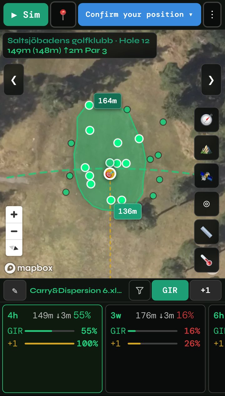
Not an average. Your shots.
Most golf apps give you one distance per club. ShotPlan uses the spread of your actual shots – how far you really carry, and how far left and right you really miss – and puts them on a satellite map of the hole.
Your shot patterns
Import your club statistics, or generate a starting bag from your handicap. Log shots on the course and the picture gets sharper.
Real terrain
Fairways, greens, bunkers, water, trees and out of bounds are drawn on the map. Elevation and wind change how far each club carries.
Clear recommendations
For every combination of clubs, you see the chance of a green in regulation and the chance of getting there with one more shot.
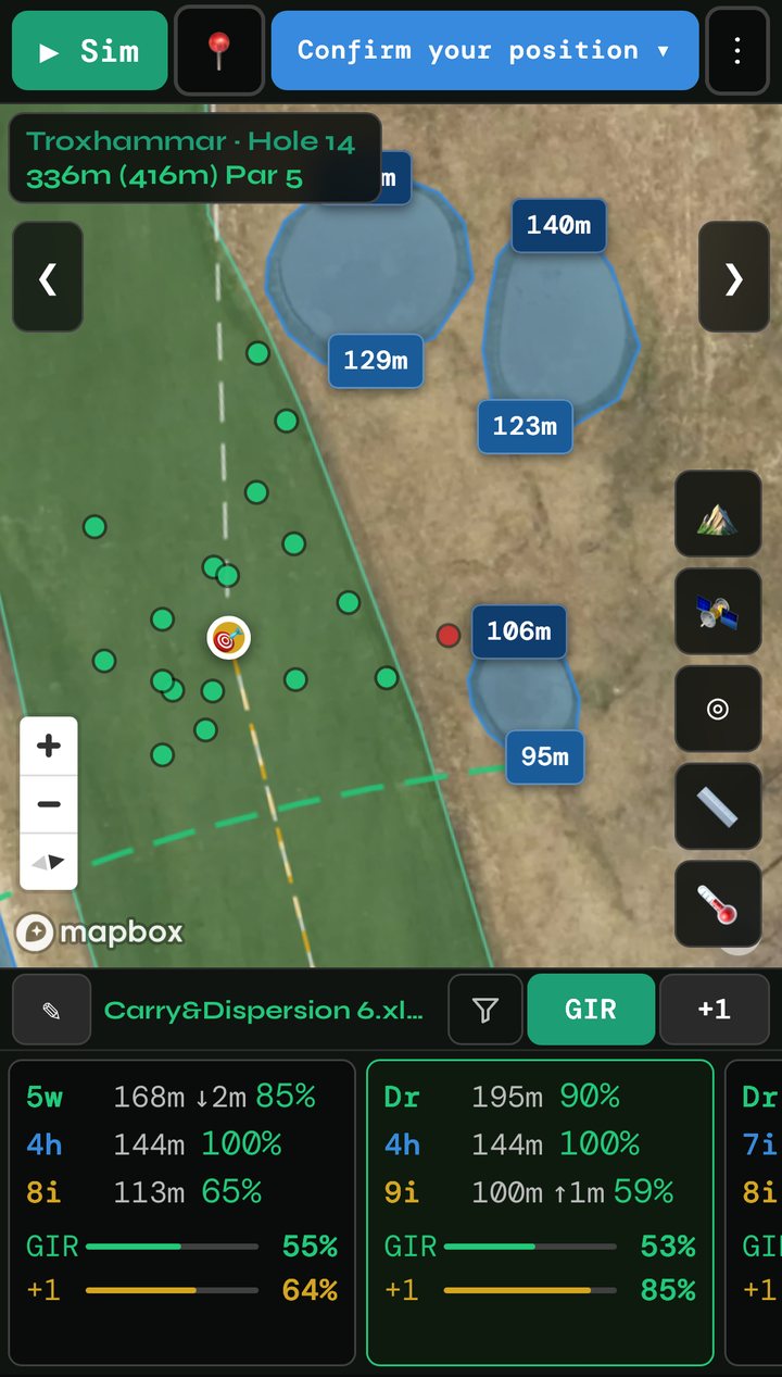
See the risk before you swing.
Every dot is one of your own shots, played from the tee along the aim line.
Safe, in play or on the green
A miss: water, trees, out of bounds or a bunker
The aim is chosen to keep the dots away from trouble. A bunker is better than a lake, and out of bounds is worse than both – so the aim moves accordingly. You can drag it to a line you prefer.
Compare club combinations.
On a par 4 or 5, should you hit driver or lay up? For the approach, which wedge from which distance? ShotPlan lists the combinations side by side, each shot with its own colour on the map, and two numbers for every combination.
GIR – the chance of reaching the green in regulation.
+1 – the chance of being on the green with one extra shot.
Short shots with a wedge are simulated as partial swings, so a 30 metre pitch is treated like the real shot it is.
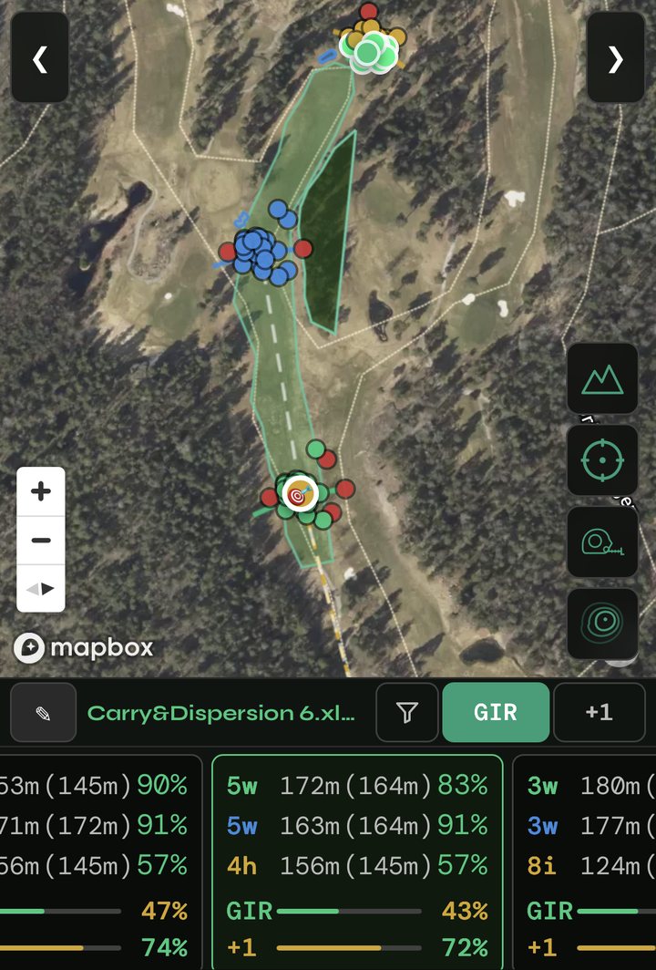
The whole course at a glance.
The course overview shows all 18 holes on one map. Tap a hole's tee to dive straight into it. At the top you get an expected number of greens in regulation for the round, for example Expected GIR 7.4 of 18 = 41%, with the range you are likely to land in.
Built for the golfer who likes numbers.
Courses on the map
Search for a course and ShotPlan fetches its layout from OpenStreetMap, or draw your own holes on the satellite image.
Your bag, your units
Meters or yards. Roll, firm or soft conditions and green speed are all adjustable.
On the course
Confirm your position with GPS, and your logged shots feed back into the next plan.
Questions or ideas?
ShotPlan is built by one person who plays golf. Write to me.
support@golfalytics.se